 Список статей
WIKI

Geodetic information system «Geoproject 4»
The geodetic information system «Geoproject 4» is a specialized universal system for processing the results of geodetic measurements and cadastral registration. The program was developed especially for surveying, cadastral and geodetic companies. Nevertheless, it can be used with equal success in other similar fields, for example, in the field of technical inventory of real estate. GIS «Geoproject 4» solves most of the tasks assigned to cadastral enterprises.
Interface
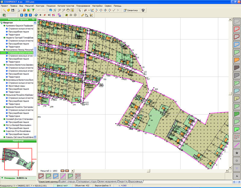 The system provides a simple, convenient and intuitive interface for working with electronic maps. Provides creation and processing of contours of land parcels and lands. Comfortable possibilities of map navigation. The size of the map is limited only by the capacity of the computer.
User-friendly interface facilitates input and processing of geodetic data. In the interactive mode you can immediately view reports and diagrams of the performed calculations. The system allows you to process individual theodolite courses (closed, open, hanging, coordinate, tachymetric) and their combinations, as well as linear-angle networks and topographic surveys. The coordinates of points can be recalculated at any stage of the work, with the subsequent modification of contours on the plan.
Object semantics
 Semantic characteristics for each object on the map are entered in a user-friendly form without codes and abbreviations. The use of unlimited number of user-defined classifiers is supported, which allows to minimize manual work. The number of semantics for objects is unlimited. Their composition and behavior can be easily changed.
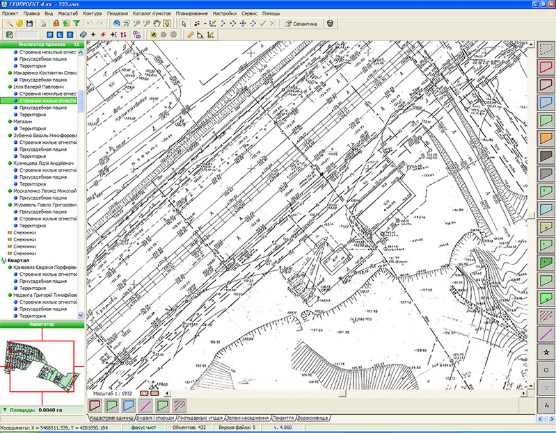
Do you want to use raster as a substrate for your electronic map? Please do! It is allowed to upload and link raster images. The guaranteed image size is 10000x10000 pixels. Raster images are saved in a single project file.
Report Generator
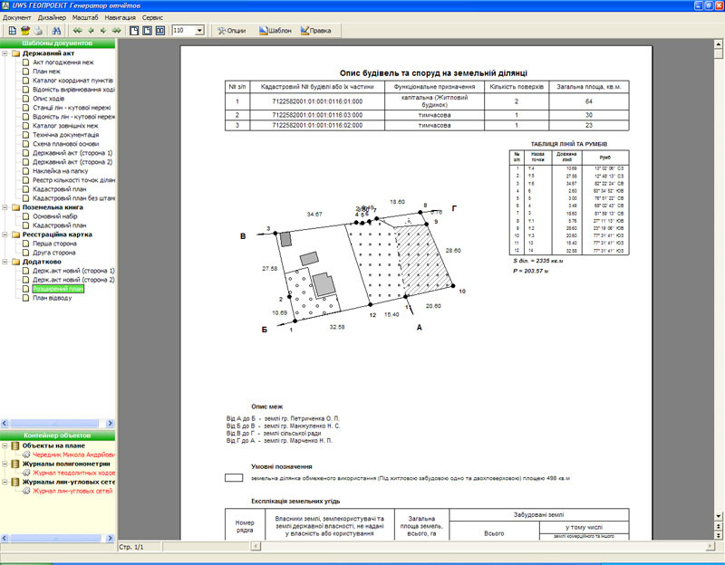 Powerful report generator «FastReport» with built-in programming language, high quality graphics and necessary service functions allows the user to create reports of any complexity and configuration. All reports are created on the basis of flexible templates, are fully automated and in most cases do not require final editing.
The basic composition of the program, as an example and a basis for further creativity, already includes templates of the main documents: «Cadastral File», «Land Book», cadastral plans, land use boundary plans, state act, registration card, catalogs of coordinates, lines, etc.
Data export and import
One of the main requirements of cadastral GIS is the creation of an exchange file in the format established by the state regulator. In GIS «Geoproject 4» this is solved by pressing only two buttons. All the rest of the work is done by the «Wizard of exchange file export». On the other hand, the «Import Exchange File» wizard will easily load cadastral data from the exchange file and check it for errors and contour integrity. All procedures with exchange files are performed on the basis of flexible format templates. In addition to IN4 format, the system exports/imports cartographic and cadastral data in GBD, DXF, MIF, DBF, TXT file formats.
Customizability
 Everything concerning the operation of the system is contained in the so-called «System Scenario». Here you can find data on symbols used for building contours of land parcels and plots. The user can add, delete and change the composition and appearance of these symbols. In the script it is possible to add and manage semantic properties for objects and work with layers. There is also an editor for custom classifiers, which allows to simplify the input and processing of the semantic part of objects. With the help of a script you can fundamentally change the behavior and appearance of the system, as well as adapt it to the conditions of your organization as much as possible.


