 Список статей
WIKI

Geodetic information system «Geoproject 5»
The geodetic information system «Geoproject 5» (GIS) can be used in all areas related to cadastre, geodesy, cartography. The program complex is designed to unite in a single, for the user intuitive system, many types of interrelated work. The system allows to process geodetic measurement data, to create an electronic map of the area, to manage and monitor electronic maps, to keep records of spatial and attributive information on objects, to provide printing of cartographic and various reporting information. Since the structure and parameters of GIS are mostly customizable, it allows to adapt it to different user requirements. The main areas of GIS application are land, forest, water cadastre, architecture, geodesy, cartography, topography, etc.
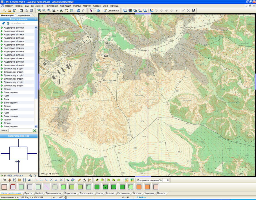
User-friendly interface
 The system provides the user with a simple, user-friendly and intuitive interface for working with electronic maps. GIS is logically divided into several modules (subsystems), which are interconnected and integrated into a single control system. All control elements are convenient and clearly arranged. A detailed user manual is included in the delivery. Training personnel in basic GIS skills is easy. Basic settings are already oriented to the main GOSTs and regulations.
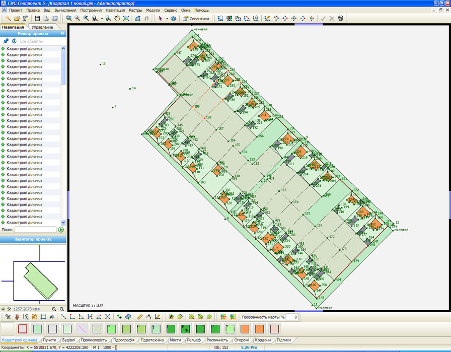
To create digital vector plans and maps, the user has at his disposal more than 600 standard symbols in accordance with the standards for topographic plans in the scale of 1:500 - 1:5000. The symbols can be added and edited using the built-in editor. Basic settings and templates are already working blanks and in most cases do not require cardinal changes and revisions. The package includes sample projects for training purposes.
Powerful geodetic module
 The GIS Geodetic Module allows you to process field measurement data and perform basic geodetic constructions and calculations. Among them:
- Calculation of basic types of theodolite movements
- Calculation of linear-angular meshes
- Construction of serifs (6 types)
- Transform coordinates of points and objects
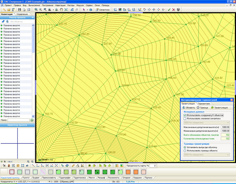
- Interpolation of horizons
- Interactive area division
- Geodetic instruments
In addition to manual input of geodetic measurements, GIS allows importing data from external files and electronic total stations. The system is also capable of interpolating horizons from topographic survey results.
Flexible Report Generator
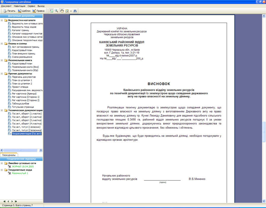 Powerful report generator «FastReport 4 Professional» with built-in programming language, high-quality graphics and necessary service functions allows the user to create reports of any complexity and configuration. All reports are created on the basis of flexible templates, are fully automated and in most cases do not require final editing. Access rights can be set for the use of specific documents, including the right to view and edit. The basic delivery set already includes basic types of documents, e.g. «Technical Documentation», «Cadastral Plan», «State Act», «Registration Map», various geodetic calculation sheets, schemes, etc.
Full-scale printing
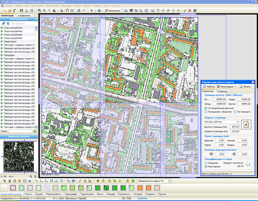 With the help of direct full-scale printing tools built into GIS you can easily and quickly create hard copies of electronic maps. In interactive mode it is possible to set necessary printing parameters, divide map image into pages, make selections and print pages on printer or plotter with subsequent joining of sheets. The entire process of preparing the map for printing can be visually monitored by the user on the screen. Using standard Windows printing methods, no special printer calibration is required.
Raster and XML files, IN4
 In many cases, in addition to the vector map, it may be necessary to apply to the electronic map separate raster fragments from graphic files, thus creating a «raster substrate» for further analysis. For example, it can be a part of a scanned map or a tablet with a plotted situation, a part of an urban area or a field. GIS allows you to load graphic files into the project. In this case you can specify the parameters of the image location and its binding to the coordinates on the terrain. In addition, using built-in functions you can set the transparency of the raster image and thus combine it with vector objects on the terrain.
The main feature of any cadastral program is its ability to work with exchange files of cadastral data in «XML» and «IN4» formats. GIS «Geoproject» allows to create an exchange file by pressing only two buttons. The reverse process of importing a file into GIS is no more complicated than its export. All routine tasks are performed by special export/import wizards. Work with exchange files is based on flexible templates that can be easily customized by the user. In addition to «XML» and «IN4» files, GIS provides export/import of data to many other popular formats.
Create your own GIS! In addition to the existing functions, GIS «Geoproject» provides an opportunity for third-party programmers to extend GIS capabilities to their taste using API functions provided by the system. Additional modules (plug-ins) can be created in any programming language and linked to the GIS using dynamic DLL files.


